Before the Phone Map: How Travellers Found Their Bearings
Before the phone map, travellers used landmarks, printed maps and local directions; learn how each can help you understand a route and recover when plans shift.
Before phone maps, travellers found their bearings by matching landmarks, street signs and printed lines to the place around them. Those same skills still help when a digital route is unclear: each clue gives a different way to understand where you are and what lies ahead.
Landmark directions describe a route through recognisable places. Printed maps show how streets and districts relate. A phone map follows your position and offers immediate prompts. None removes the need to interpret the surroundings; each asks you to pay attention to something different.
Landmark directions connect a route to visible places
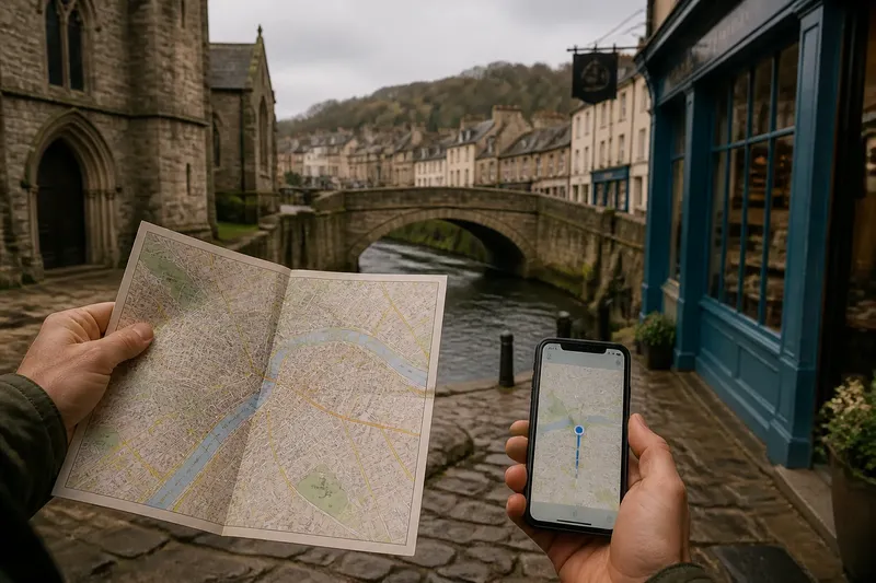
“Turn left after the stone church, then follow the road to the river” gives a traveller a sequence of things to look for. It does not show every nearby street, but it can be easier to follow than a list of unfamiliar road names.
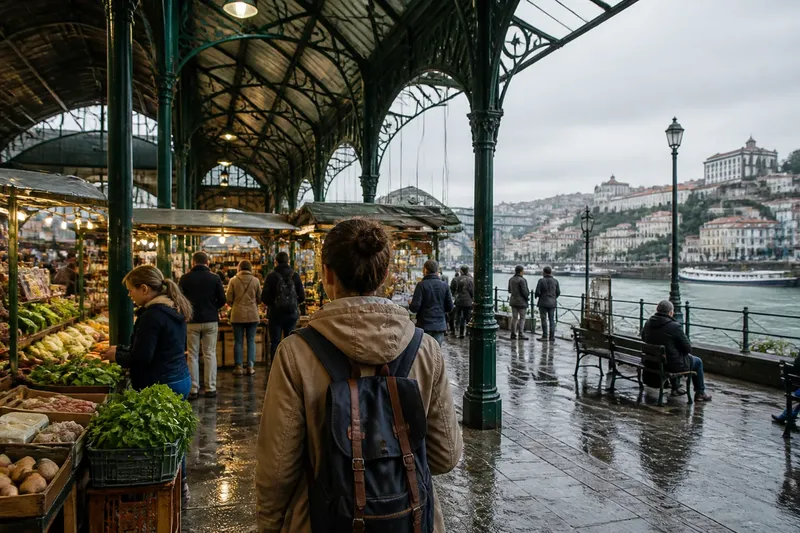
Markets, railway stations, bridges and distinctive shopfronts can all serve as useful reference points. Local directions may also include names absent from formal maps, or explain which side of a building to pass. Their value comes from describing the place as people recognise it.
The weak point is ambiguity. “Near the old mill” may mean little to a visitor if several streets meet there, and a familiar landmark can be obscured, closed or renamed. If a direction depends on a feature you cannot identify, ask for a street name or another nearby point rather than guessing.
Say you are walking from a bus stop to a guesthouse in a town with few street signs. A café owner says to pass the blue-fronted bakery, cross the small bridge and turn uphill at the church. You check each feature as it appears; if the bakery has changed its frontage, you ask someone nearby which building the directions meant before choosing a turn.
Printed maps reveal routes beyond the next turn
A printed map puts streets, public spaces and neighbourhoods on one surface. You can see that the station is south of the river, that two roads reach the same square, or that a street bends around a hill. Spoken directions tend to describe one path; a map lets you compare several.
That overview helps when a street is closed or a crossing feels unsuitable. A folded city map, an atlas page or a transport map from a local information office may show another bridge, a parallel road or a useful pedestrian route.
Reading a paper map takes interpretation. Match its symbols to visible features, orient the page with a north arrow, and use the scale bar to compare distances. Contour lines can indicate hills, while a basic street plan may leave out terrain.
A map is like a tablecloth spread over a crowded table: it makes the arrangement visible, but it does not move the objects for you. You still have to match its pattern to the street. The benefit is that alternatives stay in view rather than disappearing behind the next instruction.
Phone maps track position but can narrow attention
A phone map can show your location against streets and landmarks, calculate a route and revise its prompts if you take another road. This can be useful where street names are unfamiliar or a route crosses several junctions.
Following a moving marker can also make a journey feel like a sequence of commands. A voice prompt focuses attention on the next turn, while the screen may show only nearby streets. That is convenient for an immediate decision, but the wider shape of the neighbourhood can slip out of view.
Digital maps depend on the information they contain. A route may direct you to a mapped entrance rather than the one you need, and a location marker can be difficult to read in dense streets or among tall buildings. A precise-looking line is still a representation, not local knowledge about a temporary barrier or an awkward doorway.
The tools answer different questions. A phone map helps with “Where am I relative to this route?” A printed map helps with “What lies around it?” A local description can answer “Which way do people here actually go?”
Each direction method calls for a different kind of attention
Landmark directions call for recognition and, sometimes, conversation. Printed maps call for orientation and comparison. Phone maps call for interpreting a changing position and its prompts. Each shifts the effort rather than removing it.
Choose according to the route. A named square and a local description may be enough to cross a compact old centre. A printed map or a zoomed-out phone view can help you compare routes across several districts. Keep the phone ready for a junction where the street gives no clear indication of what comes next.
For a route that matters, carry some context alongside immediate directions. You might note the destination’s name, a nearby landmark and whether the main road or river runs across your route. Those details make it easier to ask for help if the screen and the street seem to disagree.
Understanding the route’s shape helps when a turn changes
Turn-by-turn prompts are efficient, but a traveller who understands a route’s broad structure has more options when a street is blocked. “Follow the river, cross at the station bridge, then head towards the square” describes a shape rather than a string of isolated manoeuvres.
Before setting off, identify the start and finish, the main road or boundary the route follows, and any obvious point where its direction changes. On a printed map, trace the route with a finger. On a phone, zoom out after checking the next turn. The aim is not to memorise every street, but to see how the route’s parts relate.
Imagine your route follows a river to a bridge, then turns towards a market square, but the bridge approach is closed. You look at the map and see another crossing upstream, then check whether its streets lead back towards the square. The route now takes a different shape, but the river and destination still give you a way to judge the alternative.
What should you use when directions become unclear?
How did people navigate before phone maps?
Travellers used printed maps, street signs, remembered routes and directions from people who knew the area. A map could show the layout while landmarks helped identify the next turn.
Are landmark directions still useful?
Yes, when a building, bridge or public space is easy to recognise. If the landmark is ambiguous or has changed, ask for a street name or a second reference point.
Is a paper map better than a digital map?
Neither suits every task. Paper gives a stable view of surrounding streets and alternatives, while a phone can show your position and revise a route as circumstances change.
What should you do if a phone map seems wrong?
Pause somewhere safe and compare street signs, visible landmarks and the route on screen. Check the destination name and nearby streets; if the mismatch remains unclear, ask someone nearby or consult a printed map.
Combining directions keeps a route understandable
Using more than one source need not mean checking each constantly. Before leaving, use a phone map to locate the destination and see the general route. Note one or two recognisable features, then consult the screen at junctions where the street does not make the next move obvious.
In a place with clear signs, follow them and use the map to see where they lead. In a dense historic centre, local directions may be more useful than a route line that treats every lane as equally legible. On a longer walk, a printed map or a zoomed-out phone view can reveal an alternative that a close-up screen hides.
Carry paper when it answers a specific need: a transport map for a complicated network, a walking map for a large park or a town plan showing pedestrian routes. Keep the phone view broad enough to retain some context, then zoom in when you need to make a particular turn. Before the phone map, travellers found their bearings by joining visible clues to remembered or printed information; the same combination still helps when a route stops making sense.